
Use case · 5G rollout
Plan and densify 5G on 3D, not 2D centerlines
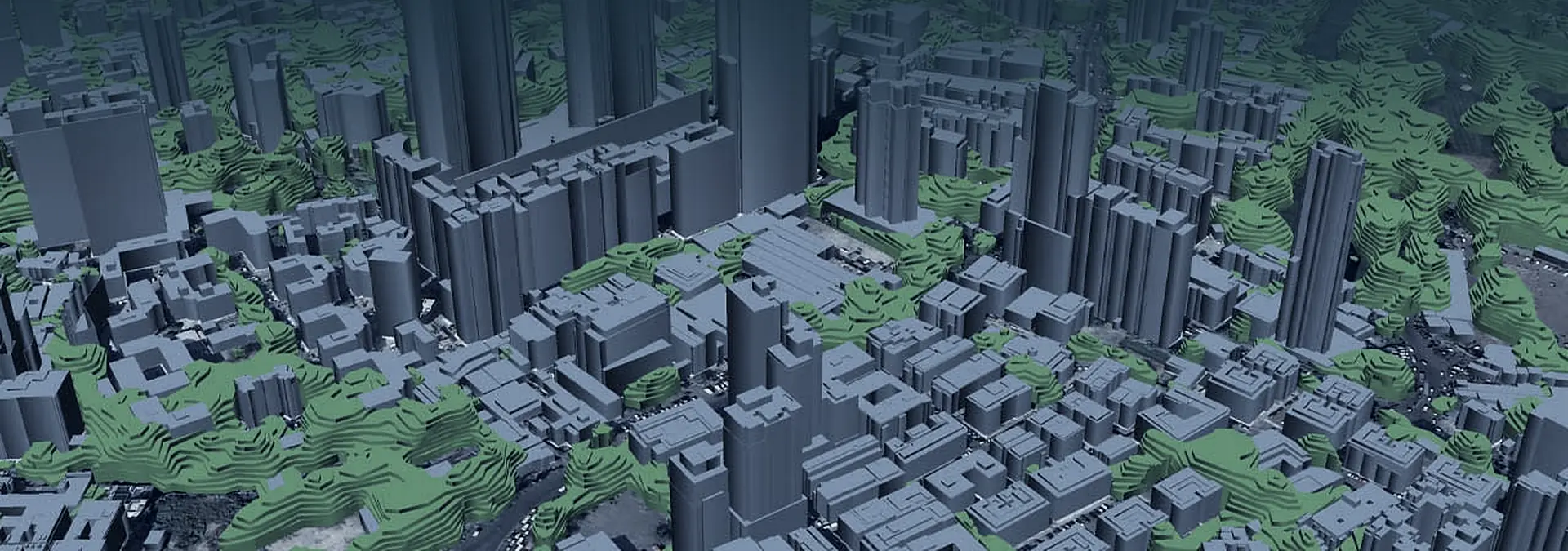
5G cells reach only 300 to 500m and die the moment line of sight is broken, so a 2D street map cannot tell you where coverage lands. rfMAP supplies the authentic 3D surface your RF planning tools propagate against: 3D buildings, vegetation with heights and clutter, so siting and densification decisions hold up on the ground.
Get a demo →The stakes
Why 2D quietly fails 5G
5G is a different planning problem. The cells reach only 300 to 500m, and they die the moment a tree line or a building breaks line of sight. A 2D street map shows you where the roads are. It cannot tell you whether a beam clears the rooftop in front of it, or where it lands in the shadow behind a tall block.
That is the gap teams keep falling into: planning on street centerlines and clutter polygons that were good enough for 4G, then discovering the dead zones in the field. At 5G ranges, the surface itself, every roof height, every canopy, every facade, is the thing that decides coverage.
What planning needs
The surface coverage is actually shaped by
Per-building, multi-polygon form
Roof heights and facades modeled building by building, so a beam either clears the structure in front of it or it does not.
3D vegetation with heights
Tree canopy as stacked polygons with real heights, the clutter that quietly kills millimeter-wave line of sight.
DTM and DSM/Clutter Height together
Bare-earth terrain and the full surface model, so propagation runs against the ground and everything standing on it.
Up to 35 land-use classes
Land-use clutter at fine grain, so attenuation reflects what is actually on the ground, not a single averaged value.
How rfMAP fits
The 3D surface your RF tools propagate against
rfMAP does not replace your RF planning tool. It supplies the data that tool was always missing: an authentic, sub-meter 3D surface that your existing planner reads directly. Because the layers are vendor-neutral, your team keeps the planning environment they already trust and simply propagates against real form instead of flat centerlines.
For densification, that is the whole game. Where macro coverage falls into a line-of-sight shadow, the 3D surface shows you the gap, and where a small cell would actually close it, before anyone is dispatched to confirm it on foot.
Coverage resolved on real 3D form, not a flat circle.
The macro lobe wraps building geometry and falls into shadow behind the tallest block. The 3D surface shows the gap, and where a small cell closes it, before a single site visit confirms it.
Objections
The questions teams ask first
- 01
2D data was fine for 4G
5G is different. At 300 to 500m with line of sight blocked by trees and buildings, planning needs 3D buildings, vegetation heights and clutter, not street centerlines.
- 02
We already get maps from our planning tool
rfMAP is vendor-neutral and feeds all major planning tools and drive-test equipment. The OEMs themselves appear in our customer list.
- 03
Satellite-derived data is not accurate enough
Multi-stereo high-resolution imagery with sub-meter accuracy, plus QA and registration workflows and per-building multi-polygon modeling.
Proof
The 3D dataset under India's 5G
This is not a pilot capability. The same authentic 3D dataset rfMAP supplies sits under the majority of India's 5G build, and it is the data RF teams at operators, network OEMs and tower companies plan and densify against.
- Airtel
- Jio
- Vodafone Idea
- Ericsson
- Nokia
- American Tower
Plan 5G coverage on a real 3D surface.
Bring a rollout area, and we will show you rfMAP feeding your RF planning tools with 3D buildings, vegetation heights and clutter.
Get a demo →