
SmartSignal · FWA feasibility and coverage
Know which buildings a site can actually serve
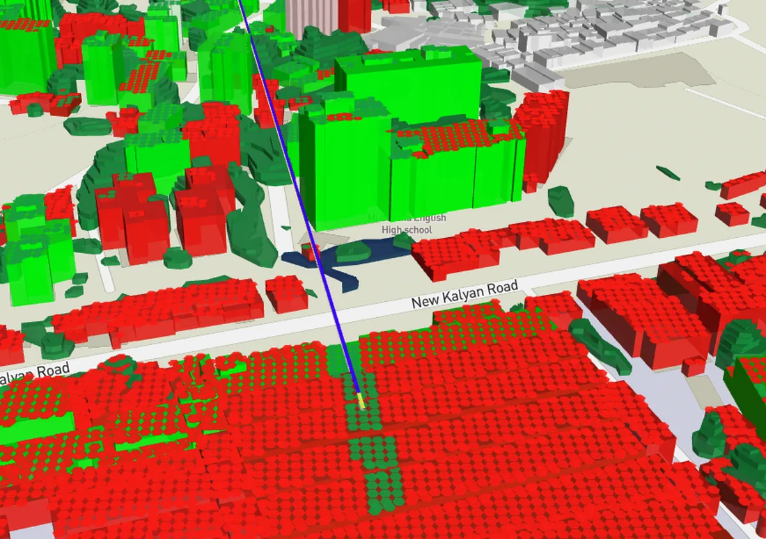
SmartSignal runs line-of-sight and coverage feasibility across a 3D city model, building by building. Set a mast height and a beam width, and every premise in range is marked served or not served, before anyone climbs a tower.
Get a demo →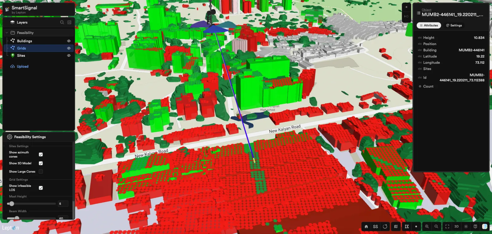
What it does
Feasibility answered per building, not per cell
Coverage maps drawn at cell level tell you a neighbourhood is covered. They do not tell you whether the roof of one particular building can see the mast, and that is the question a fixed wireless sale actually turns on.
SmartSignal works at the building. It carries the height and footprint of each structure, traces line of sight from the candidate site, and marks every premise in the service area as reachable or blocked.
Traced against real building heights
Feasibility is computed against the 3D model of the built environment, so a taller block between the mast and a premise rules that premise out rather than being averaged away.
Mast height, beam width and azimuth
Raise the mast, widen the beam or turn the sector and the served set is recomputed. Planning becomes a question you can answer in the room rather than a survey you commission.
Every building keeps its own attributes
Each structure carries its height, position and identifier, so a result is auditable back to the specific premise rather than to a coloured polygon.
What you cannot serve is a result
Blocked premises are shown, not hidden. Knowing which addresses a site will never reach is what keeps them out of the sales pipeline and out of the rollout plan.
Where it is used
The questions SmartSignal is bought to answer
- 01
Fixed wireless rollout · Where does the next site go
Test candidate sites against the premises you want to sell to, and pick the one that reaches the most of them at the mast height you can actually build.
- 02
Sales qualification · Can we serve this address
Answer a serviceability question for a specific building rather than a postcode, so a sale is not booked against a premise the network cannot reach.
- 03
Capacity planning · What a sector really covers
Beam width and azimuth change the served set. Model the sector plan before it is committed, rather than discovering the gaps from complaints.
- 04
FTTX comparison · Wireless or fibre to this cluster
Where wireless feasibility is poor across a cluster, that is the case for trenching. The two options get compared on the same footprint instead of in separate tools.
How it is sold
On its own, or with rfMAP
SmartSignal is sold as a standalone product. If you already have your own 3D city data, it runs on that.
It is also sold with rfMAP, which supplies the 3D surface it plans on: building footprints and heights, terrain and clutter at the resolution the feasibility trace needs. Most fixed wireless programmes take the two together, because the answer is only as good as the model underneath it.
- 01
With rfMAP
rfMAP supplies the 3D city model and terrain, SmartSignal runs feasibility and coverage on it. See how the surface is built.
rfMAP - 02
With NetworkAccess
Feasibility results feed the live access-network record, so what planning proved reachable is what operations and field teams work against.
NetworkAccess
Run feasibility on your own footprint.
Bring a candidate site and a service area. We will show you what SmartSignal marks as reachable, what it rules out, and why.
Get a demo →