
NetworkAccess · SmartOps
Run the field from one map
SmartOps is the geo-aware field operations layer of NetworkAccess: dispatch the right technician to the right job, optimise each crew's route, and track every visit live, so the work that closes a network ticket happens on time.
Get a demo →The job
Every ticket ends in the field
A serviceability answer, a new install, a fault to clear: the decision is made on the map, but the work happens on the ground. Whether the crew arrives at the right place, with the right skill, on time, is what turns a planned task into a closed one.
When dispatch runs on phone calls and spreadsheets, the nearest available technician is a guess, routes double back across the territory, and no one knows where a job stands until it is already late. SmartOps puts the same field workforce on the same live map the network runs on.
What SmartOps does
Plan, dispatch and track on one map
Smart dispatch
Assign each job to the nearest available technician, matched on location and skill, instead of working a call list.
Route optimisation
Sequence each crew's day to cut drive time between sites and fit more visits into the same shift.
Live tracking
See every technician and job status on one live map as the day unfolds, not after the fact.
Field capture
Capture geo-tagged photos, forms and sign-offs at the point of work, so the record closes with the job.
Assign, route and track from one live screen
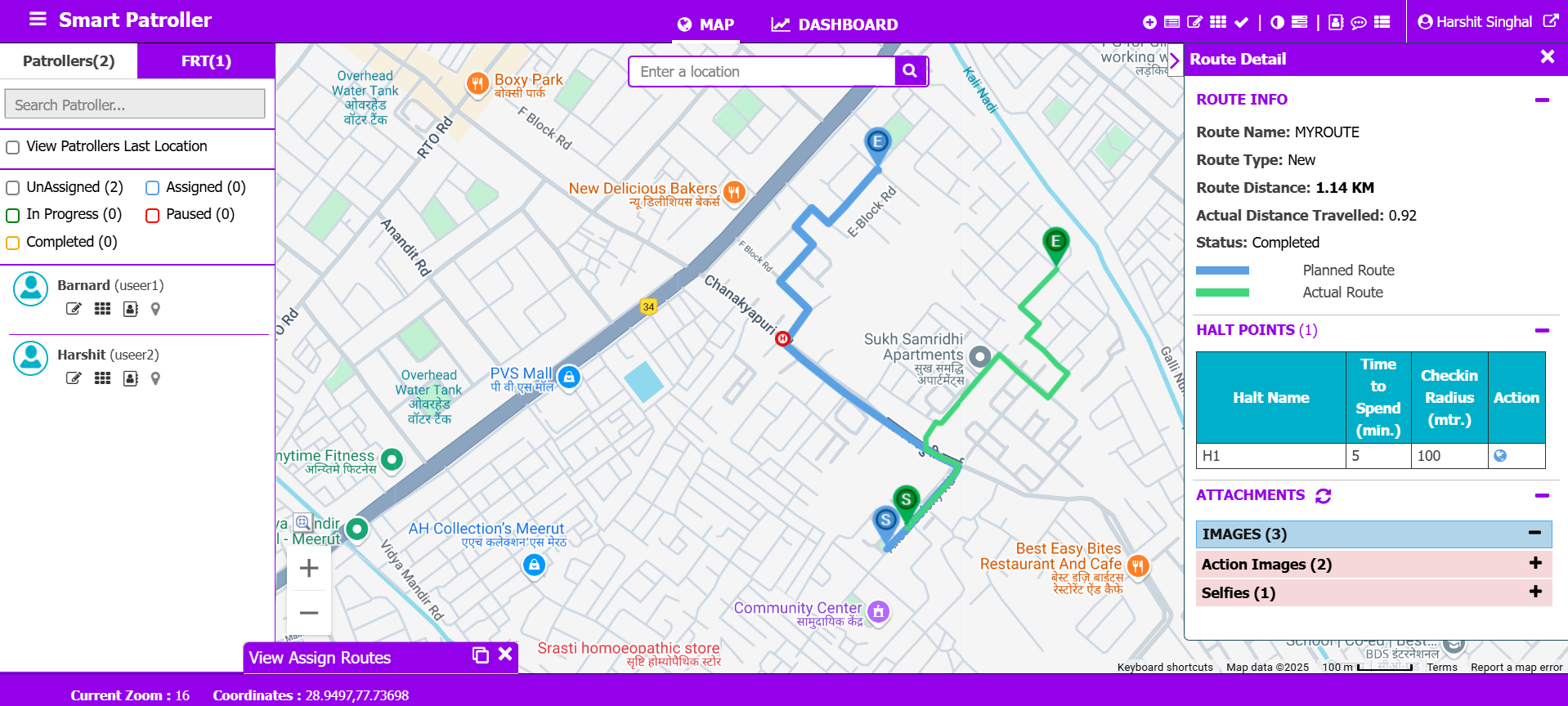
Field operations run as a board tied to the live network map. The crew rail lists field staff and filters them by the state of their work, unassigned, assigned, in progress, paused or completed, so a dispatcher sees who is free before assigning anything.
On the map, the planned route is drawn against the route actually travelled. The route panel carries the distance planned against the distance covered, the halt points with their check-in radius and dwell time, and the photographs captured at each stop, so the visit closes with its own evidence attached.
One territory
One live map, depot to doorstep
SmartOps treats the territory as the interface. Jobs, crews and routes sit on the same basemap as the network they serve, so the team plans, dispatches and tracks against one shared picture instead of reconciling separate lists.
Because the field runs on the same geospatial layer as planning and serviceability, the work that closes a ticket stays tied to the location it belongs to, from the moment it is dispatched to the moment it is signed off.
The whole field, dispatched and on the map.
Crews leave the depot, follow the route SmartOps sequenced, and close each task where it sits on the network. One live picture, from dispatch to sign-off.
How it fits
Field operations, inside NetworkAccess
SmartOps is the field arm of NetworkAccess. The same geospatial record that answers serviceability and drives planning is what dispatches the crew, so the team in the field works off the truth the network already holds, with no second system to reconcile.
What it changes
From call lists to a live operation
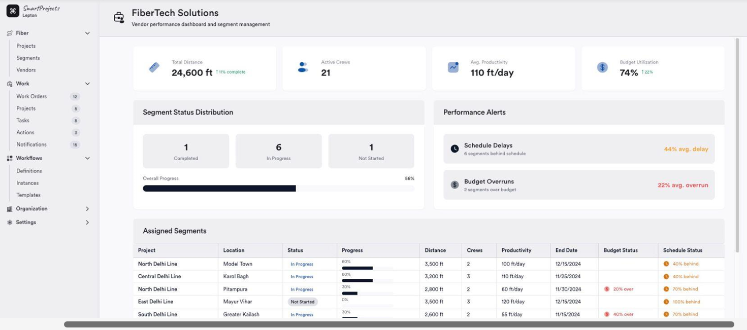
The gains show up where the work is counted: in the build and work-order view, where crews, segments and productivity are read off the same record the field is working against.
The right tech, faster
Dispatch by location and skill, so the nearest qualified crew takes the job instead of whoever picks up.
Less drive, more visits
Optimised routes cut the distance between sites, so each shift fits more completed work.
No status black hole
Live tracking shows where every crew and job stands, so problems surface while they can still be fixed.
The record closes with the job
Geo-tagged proof captured in the field means the task is documented the moment it is done.
See SmartOps run your field.
Watch dispatch, routing and live tracking on a real territory with our team.
Get a demo →