In today’s rapidly evolving technological landscape, the way we understand and interact with our world is undergoing a profound transformation. A predominant breakthrough has been 3D Geo-Data; This technology not only enhances our spatial understanding but also revolutionizes various industries through immersive experiences and interactive applications. From urban planning to virtual reality, 3D Geo-Data is shaping the future in unprecedented ways.
Development of 3D Geo-Data Systems.
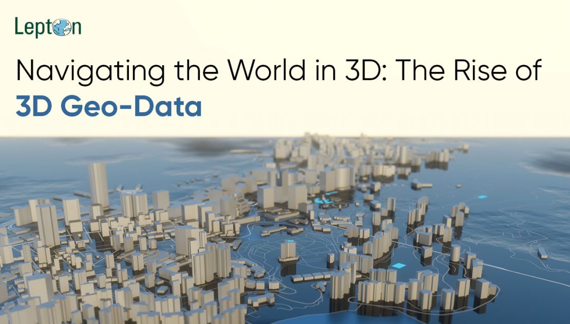
3D Geo-Data refers to visualization of geographic functions in 3 dimensions. Unlike standard 2D maps that display horizontal information, 3D Geo-Data takes under consideration depth and elevation, offering a greater comprehensive photo of terrain. Its technology is built around spatial visualization; enabling users to perceive and recognise areas with more precision and depth.
LiDAR (Light Ranging and Detection), photogrammetry and satellite TV for computer imagery all play an essential element in the boom of 3D Geo-Data, with each imparting precise measurements of Earth’s surface generating high-resolution point clouds and 3D models. Furthermore, satellite TV snapshots and aerial images in addition have enriched the scope of 3D Geo data.
Transforming Urban Planning and Development
One of the important advantages of 3D Geo-Data is city planning. Traditional urban plans rely on static 2D blueprints which couldn’t absolutely constitute the real world’s environment ; now with 3D Geo-Data urban planners can design interactive and dynamic metropolis designs which allow more informed decision making whilst offering better visualization of proposed development.
Urban planning applications utilize 3D Geo-Data to analyze building height, visualizing infrastructure projects and assessing environmental impacts. By using real-time data combined with simulations, architects can quickly analyze unique situations and optimize designs to enhance urban living. For example, newly constructed buildings may be evaluated for sunlight exposure and shadow casting effects over adjacent regions ensuring a harmonious integration into the urban fabric.
Enhancing immersive experiences
3D Geo-Data features has emerged as an enterprise chief in growing immersive experiences via virtual and augmented realities (VR/AR) software. These technologies leverage geospatial modeling and 3D mapping technologies to overlay digital information onto the physical world, providing users with a rich and interactive experience.
In Virtual reality 3D Geo-Data creates practical virtual environments for humans to discover, interact and play inside. This era may be especially beneficial in training in which virtual discipline journeys allow students to visit historic websites or natural landmarks to benefit extra expertise about situation matters; in addition in gaming 3D Geo-Data facilitates creating large worlds of game that boom engagement and immersion for users.
Augmented reality applications assist us better recognize by overlaying digital information onto physical objects. For example, navigation apps that show real-time directions by superimposing arrows and point of interest (POI) data onto one’s view. Moreover in manufacturing and construction AR applications allow stakeholders to visualize building designs live, this facilitates better communication and collaboration throughout teams.
Revolutionizing Geospatial Modeling and Analysis
3D Geo-Data extends its capabilities beyond visualization and immersion; it plays a crucial role into geospatial modeling and evaluation by enabling professionals to conduct more accurate and detailed studies. Through integration into geo visualization equipment, 3D Geo-Data permits specialists and researchers to conduct more specific and original studies.
3D Geo-Data may be applied as a part of the environment to model natural phenomena like floodplains, landslides and coastal erosion. These models help scientists predict the impacts of natural disasters, which ultimately saves lives while reducing economic losses. 3D Geo-Data also assists geologists in extraction of natural resources through detailed information about subsurface structures.
3D Geo-Data also plays a crucial function by developing smart cities. By developing virtual digital twins of urban regions, urban planners monitor and manage infrastructure in real time. This includes tracking transportation performance networks, analyzing energy consumption, and optimizing waste management structures as well as enhancing waste disposal systems. Integrating 3D Geo-Data with IoT boosts information gathering from different resources that contributes to more efficient and sustainable cities.
Interactive Mapping: A Unique Way to Navigate
Interactive mapping is another area in which 3D Geo-Data is making a significant impact. While conventional maps are static and lack the ability to show complex spatial records, interactive maps powered by 3D Geo-Data provide an engaging and dynamic way of analyzing geographical information.
Interactive maps offer users the power of rotating, zooming out/in, tilting, to gain specific perspectives of a map. POI data (Point of Interest) can be overlaid onto the map providing information about locating eateries as well as landmarks and public offerings. Interactive maps are extensively applied in tourism, real estate and logistics fields wherein it enhances user experience by providing relevant and up-to-date statistics.
Tourists, as an instance, can make use of interactive maps for route planning with the aid of locating points of interest and amenities alongside their tour direction. Real estate marketers can show homes the usage of 3D models that allow consumers to search from the tool with no trouble. Real property marketers additionally benefit from dynamic maps for actual property sales purposes that display houses with specific 3D models that allow buyers to quickly seek homes with the usage of specific 3D models on mobile gadgets. Lastly, logistic corporations benefit from dynamic maps which optimize shipping routes while simultaneously circulating track shipment thereby enhancing overall performance while growing customer satisfaction.
Conclusion:
As technology progresses, 3D Geo-Data programs will grow to be extra effective. Leveraging Artificial Intelligence (AI) and Machine Learning (ML), with 3D Geo-Data gives promising approaches to acquire even better analytical and prediction abilities. AI algorithms can process a large amount of geospatial records fast so that one can come across trends or patterns, giving valuable insight for decision makers.
AR and VR generation advances are revolutionizing our use of 3D Geo-Data, from training simulations to remote collaboration. I will become integral for many industries, improving innovation and increasing effectiveness of your commercial enterprise operations.
At its core, 3D Geo-Data is revolutionizing our knowledge and interaction with industry. Its application in urban planning, immersive reports, geospatial models and interactive mapping are revolutionizing industries and enhancing our daily lives. As we discover all its competencies it is certain that 3D Geo-Data will play a critical part in shaping each physical and digital landscape in future.
