In the era of digital transformation and GPS-based location services, PIN codes might seem outdated—but they are far from it. Pincode boundary maps continue to play a vital role in business intelligence, logistics, planning, and location-based analytics. Especially in a geographically diverse country like India, pin code mapping provides a dependable method to map service availability, delivery zones, and customer segments.
What Is a PIN Code Boundary Map?
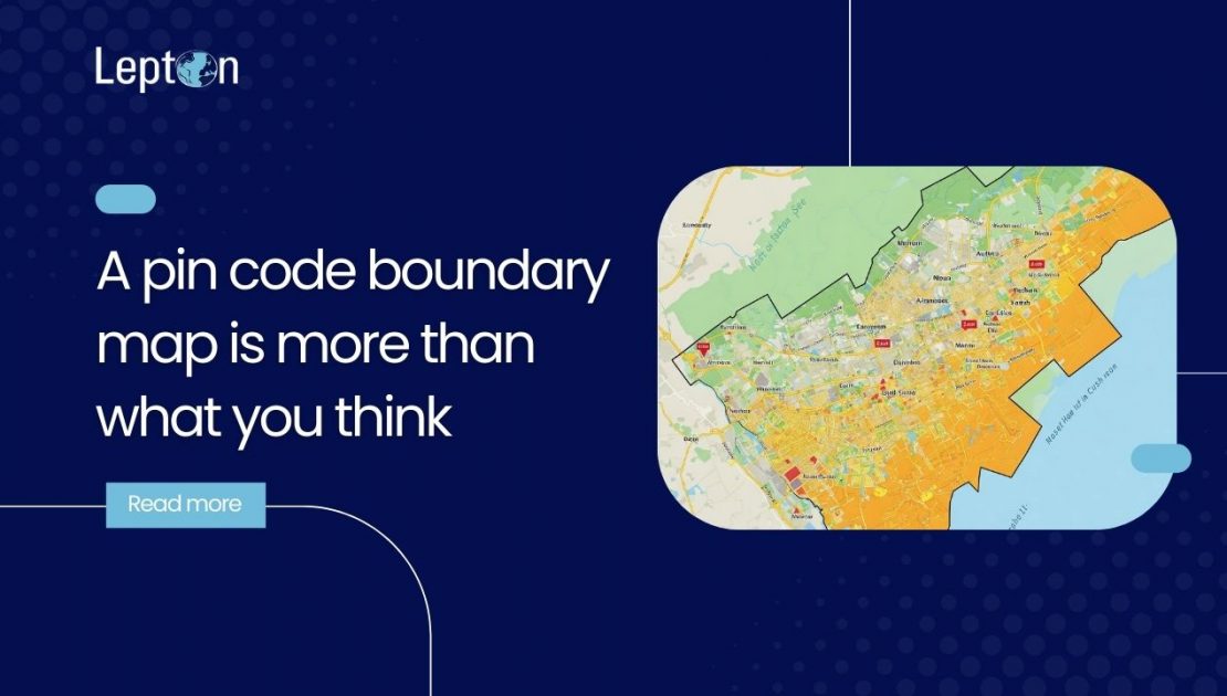
A pin code boundary map is a geospatial layer that outlines the territorial boundaries associated with postal codes. These maps can be used to map PIN codes visually across a digital interface, enabling businesses to perform pincode to city mapping, service region planning, and much more.
These boundary maps help users pinpoint specific areas, understand consumer density, and make location-based decisions that enhance both efficiency and accuracy.
Why Businesses Still Rely on Pincode on Map Solutions
Even with satellite technology and real-time navigation systems, pincode on map tools remain essential for a variety of use cases. These are especially valuable in rural and semi-urban areas where PIN code data often provides the most consistent and structured geographical reference.
Key Applications of Pin Code Boundary Maps in Business
1. Marketing and Customer Segmentation
With pin code by map tools, marketers can segment customers more effectively. These maps allow businesses to plan targeted campaigns by territory and optimize regional advertising budgets.
2. Delivery and Logistics
E-commerce and logistics companies use pin code software to streamline delivery operations. By mapping serviceable regions accurately, companies can reduce delays, optimize last-mile delivery, and expand service coverage seamlessly.
3. Sales Territory Management
A visual map pin code interface allows sales teams to track performance, coverage gaps, and customer density. This enhances decision-making regarding workforce allocation and regional outreach.
4. Location Intelligence and Urban Planning
Government agencies and urban planners leverage pincode boundary maps to study demographic trends, plan resource allocation, and implement smart city strategies.
Power Your Location Data with Lepton’s Pin Code Mapping Solutions
Lepton Software is a leading provider of postal code mapping solutions. We specialize in customized pincode to city mapping tools that integrate easily with enterprise systems. As a certified partner of India Pin, we offer the most accurate and up-to-date PIN code datasets available.
Our solution includes:
- High-resolution postal code boundary data
- Pincode-to-lat/long conversion and vice versa
- Custom GIS layers (demographics, service zones, network coverage)
- Seamless integration with CRMs, ERPs, and BI tools
- Periodic updates and complete data accuracy
Benefits of Using a Pin Code Boundary Map
Simplifies regional targeting
Identifies underserved regions
Enhances delivery network efficiency
Helps with pincode to city mapping for better demographic understanding
Supports business expansion strategies with local insights
Provides granular data visibility at postal boundary level
Industries Benefiting from Pin Code Software
- Retail & FMCG – Hyperlocal sales planning
- Telecom – Coverage gap identification
- E-commerce – Optimized delivery zones
- BFSI – Branch/agent network distribution
- Government – Smart city development and resource planning
Optimize Your Business Operations with Lepton’s Pincode Mapping Solutions
If you’re looking to implement high-accuracy pin code boundary maps, integrate pin code by map tools, or need advanced pincode to city mapping, Lepton Software is your go-to partner.
Contact us to turn postal data into actionable business intelligence.
